
It has been brought to the attention of the entire weather community.
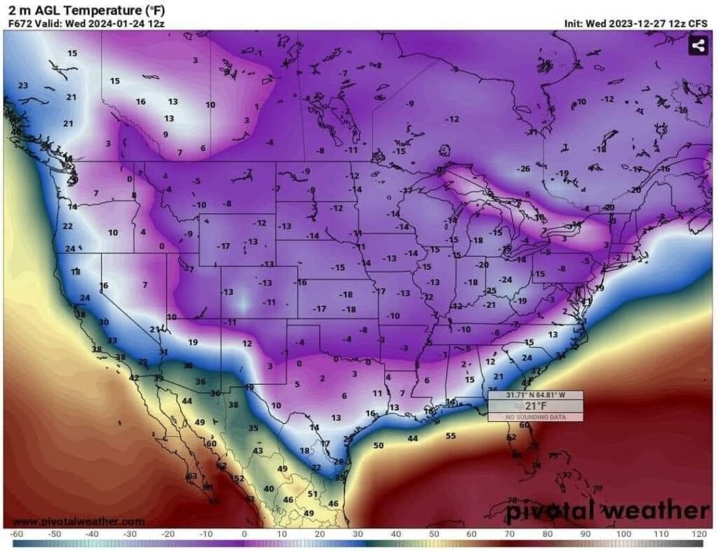
Someone shared a picture from a CFS run. Showing an extremely large polar vortex sag over the whole United States of America. This would have led to everywhere North of Central Florida being below freezing.
This is the run. If you look at the top you will see 2024-1-24. So as of today writing this is a 20 day in the future forecast, or roughly 492 hours.
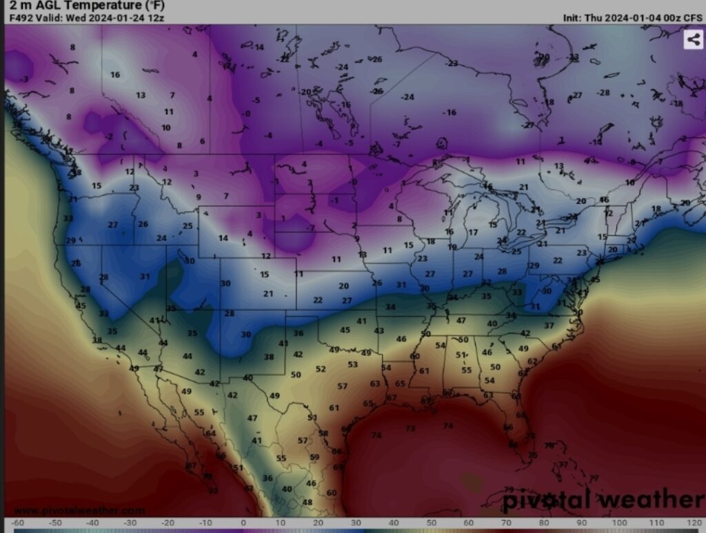
The picture on the Right, is the current run for the same time frame. This is a lot more believable. Your normal polar vortex sag is occurring in this run.
Anybody who has followed me for any amount of time has heard. This forecasting is about trending. One single run is not a trend.
This is what the climate control center in Denver, Colorado says about the CFS, or Climate control forecast system.
While the CFS data should not be used as a forecast to answer questions such as “what will the weather be at some far future point in time”, it will produce realistic transitions from day to day, with one weather system changing dynamically into another.
This model was designed for one thing to be able to locate Lows, and see switches occurring between them for patterns.
This is not the normal GFS model, and this model has only existed since September. It is what is referred to as a test bed model. So far it has pretty well been a failure of a model. The Climate control forecast system goes out 768 hours, and has proved to be completely unreliable.
Distance goes to show the impact. 1 person who has no idea what they’re doing. Forecasting can make in the world of weather. Next time I would ask the question. What is the trending?