

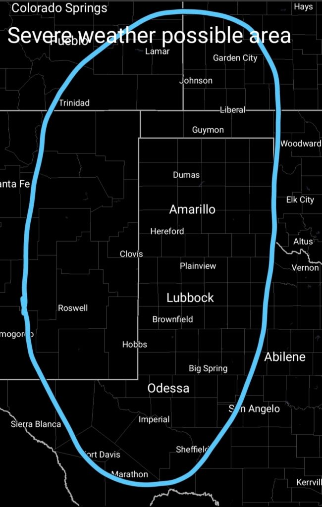
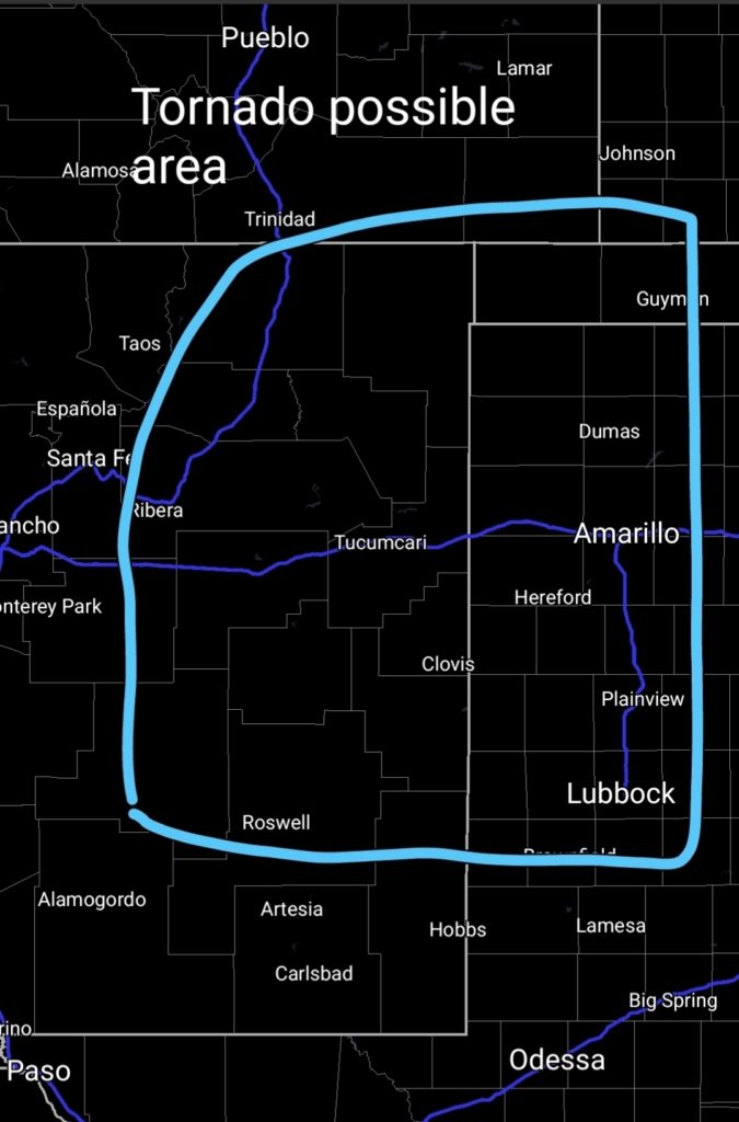
After a day of severe weather over New Mexico and the Texas panhandle today, Tuesday, 10/3/23, the same base area will be the outlined region for possible severe weather. Hazards include 60 to 70mph winds, 1 to 2-inch hail, and the possibility of tornadoes. The primary tornado chance appears to include eastern New Mexico between 9 in the morning and 2 in the afternoon, with the Texas panhandle experiencing severe weather between 2 in the afternoon and 10 at night.
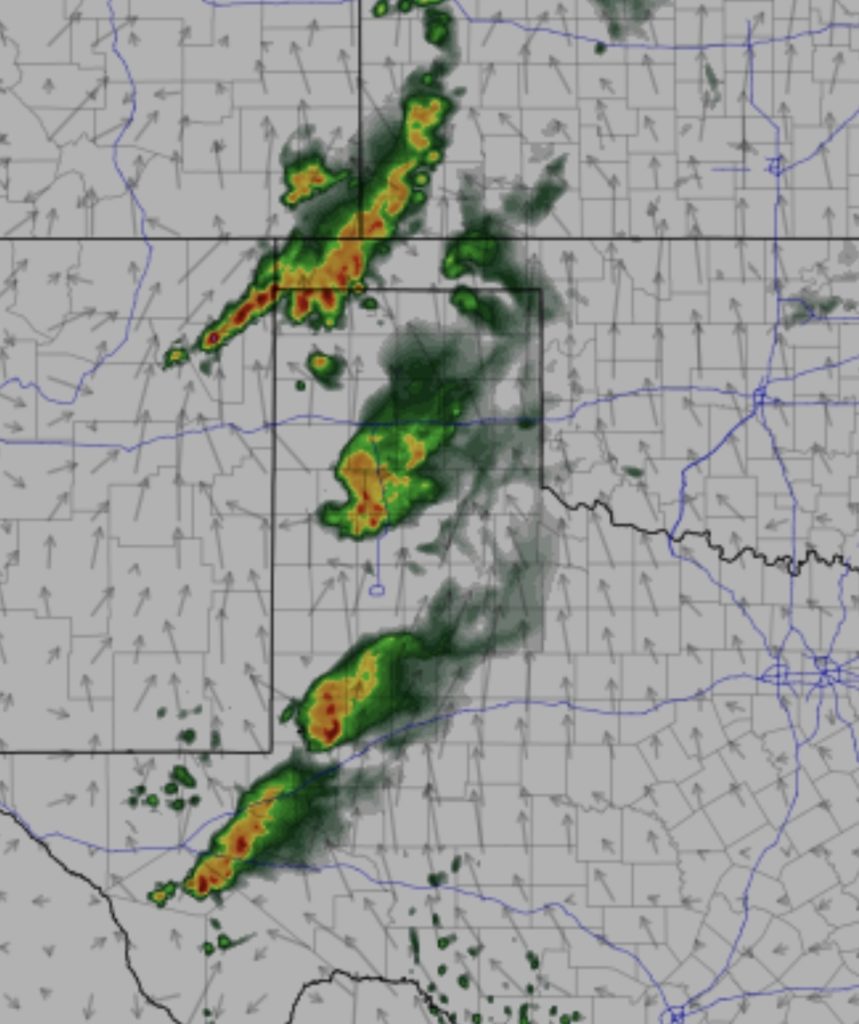
The mode is expected to be discreet, possibly supercells. The two most trusted short-range models, HRRR and NAM NEST, are showing a 30% chance of a tornado overall. Using the NAM NEST sounding, 2800 j/kg CAPE is more than enough instability to create strong cells. A 56 mph southwestern jet should lead to some rotating cells, possibly resulting in large hail.

This run is showing high-based cells at 800 mb or 5000 feet. The majority of this area is about 4200 feet above sea level, so the cells could be 800 feet off the ground.